new update

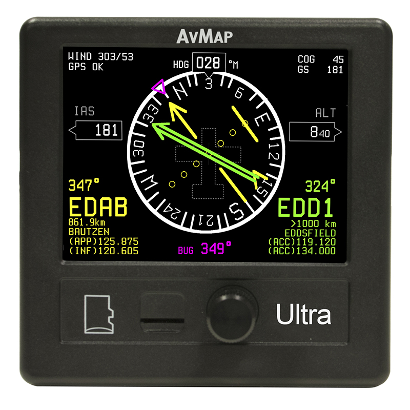
Ultra EFIS
9 Instruments in 1
Primary Flight Display and navigation backup
for light-sport, ultra-light, and experimental aircraft.
1260,00 €
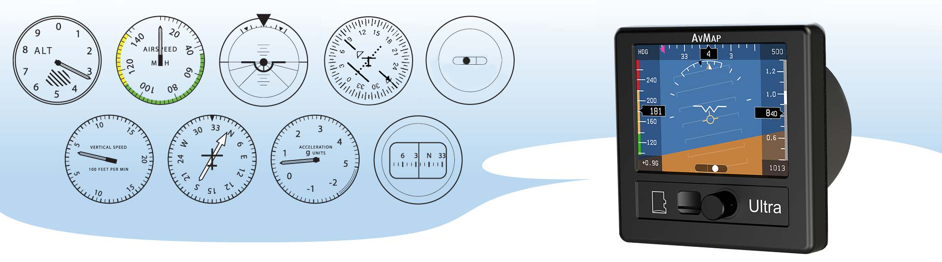
9 Instruments in 1
1. Altimeter
2. Airspeed Indicator
3. Artificial Horizon
4. Direction Gyro / HSI
5. Side Slip Indicator
6. Vertical Speed Indicator
7. Automatic Direction Finder with GPS
8. G-Meter
9. Magnetic Compass
Designed for light-sport, ultralight and experimental aircraft
Ultra light, Utra compact, Ultra Bright
Ultra light: only 8.1 oz
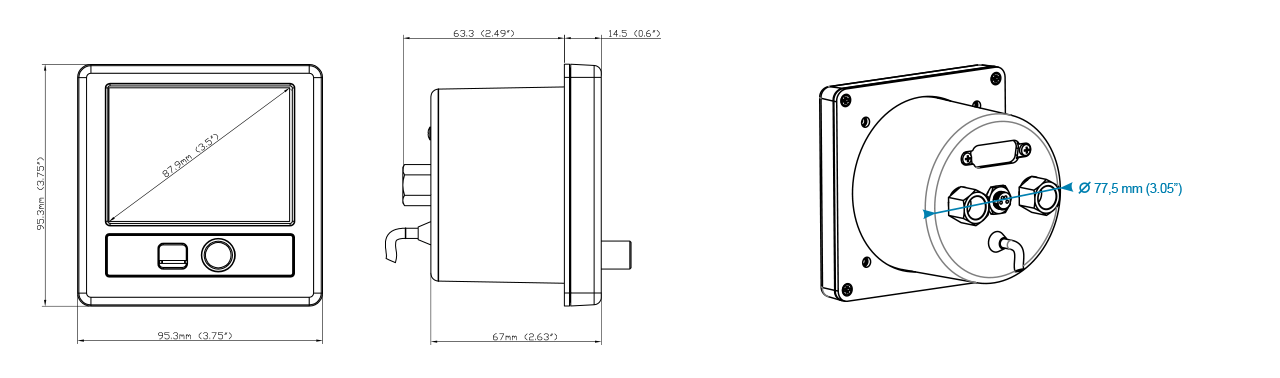
Ultra compact: only 2.49” of installing depth, and only 3.74” x 3.74” of external frame
Ultra bright: 3.5” ultra bright LCD display with 500 cd/m2 brightness
Ultra powerful
Packed with everything you need
-
3.5” ultra bright LCD
-
GPS
-
Solid state 3-axis gyro
-
3-axis accelerometer
-
3-axis magnetic field sensor
-
Pitot and Static air data sensors
-
UAV motion processor and sensor fusion software
-
Preloaded with Jeppesen database (APT, VOR, NDB)
Air Data
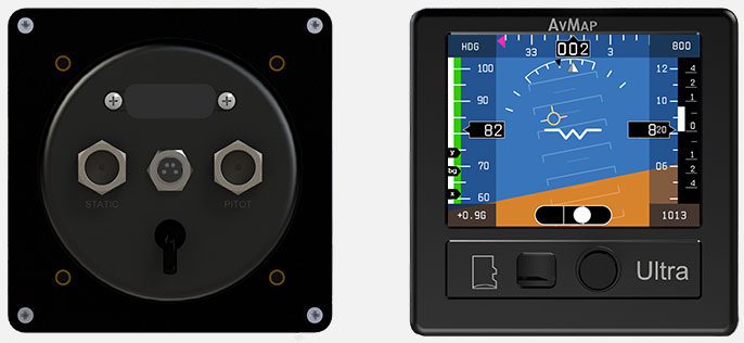
Connect Ultra EFIS to the Pitot - Static system
When connected to the Pitot-Static, Ultra provides Air Data and advanced performance!
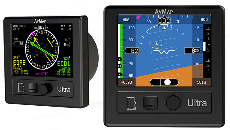
PFD and HSI pages
The AvMap Ultra can display on the 3.5” LCD two different pages: PFD and HSI. Change Page by using the rotor knob.
NEW PFD page
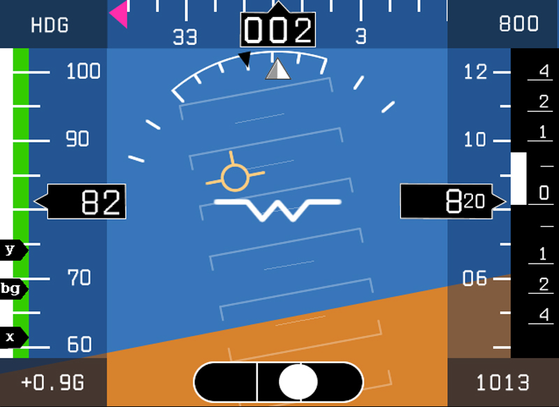
The PFD screen displays the ADAHRS data: Air Data, Attitude, Heading Reference System
HSI page
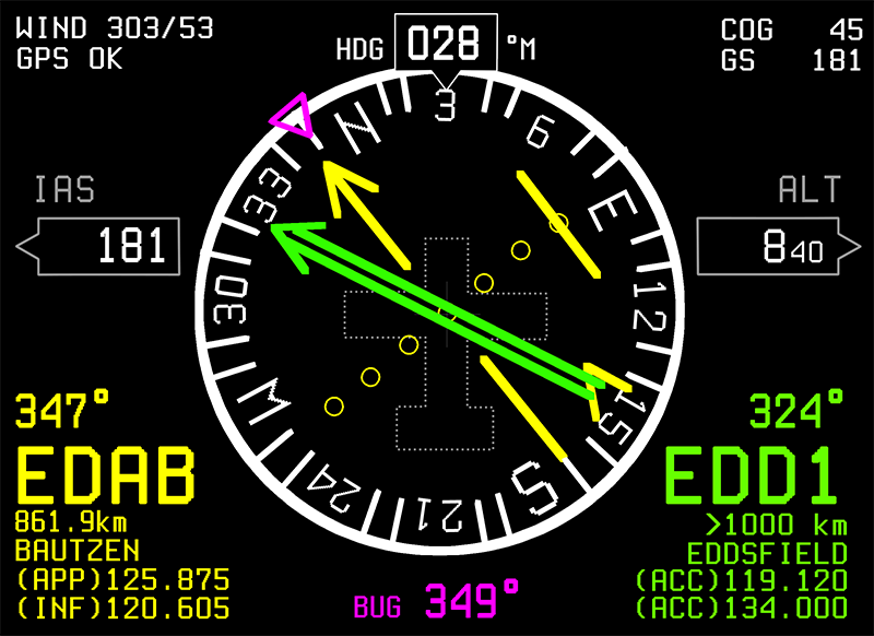
The HSI screen display: Current position, Heading Distance, Direction, Radials relative to reference navigation points, Approximate wind data.
Primary Flight Display User Experience
Your Navigation back-up!
Ultra EFIS is an Approved electronics backup instrument for LAA Aircraft in UK
The AvMap Ultra also provides navigation back-up: in the HSI screen you can select from the preloaded Jeppesen Database an Airport, a VOR station or NDB transmitter as your navigation point.
-
Preloaded Jeppesen Database
-
User Data: Insert user points and use them as navigation aid!
-
RS-232 serial interface (NMEA 0183): Send out GPS data to external devices (autopilot, transponder, navigation or EFIS system etc.).