Maps
AvMap EKP V Maps
Moving map excellence: super detailed, with the most reliable official data.
AvMap maps are the result of 30 years of navigation technology and vector maps know-how. AvMap has chosen official sources, to provide the most complete and safest maps for your flight. Our aeronautical maps include:
-
Aeronautical Database: Jeppesen data, AvioPortolano
-
Background: terrain depiction and Land Elevation for TAWS
-
Terrestrial Database: street network and Points of Interest by HERE
-
Airports diagrams & Approach plates: by Seattle Avionics
-
FAA VFR sectional charts by FAA per for United States
-
IGN OACI VFR chart for France (optional)

How to update your EKP V
Shop online
You can buy from the Shop online a new memory card for your EKP V, preloaded with software and maps complete with all the data sets.
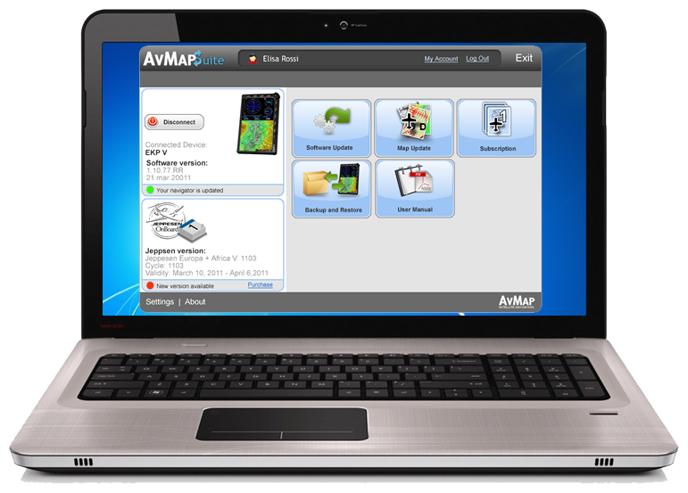
AvMap Suite
You can choose to update only one set of data: the Aeronautical Database, the Street maps or VFR charts by downloading them through the AvMap Suite: it is cheaper and faster!
Aeronautical Maps Update Service
You can also subscribe to the Maps Update Service, the most convenient way to keep your EKP V complete and updated.
New Map Guarantee
Get the latest Jeppesen database for free!
When you buy an AvMap EKP V, you are guarantee for free the latest released Aeronautical Database (Jeppesen data). Get your free update through the AvMap Suite:
- If you have not registered yet, register here
- Download the Suite here and install it on your PC / MAC
- Connect your EKP V to the PC and open the Suite and check if a new Database is available for you!

Attention: to have access to the latest available maps, you need to check the availability within 30 days from the first use of the EKP V (from the first acquisition of satellites at a certain speed). You can download only one free map update.
AvMap maps explained
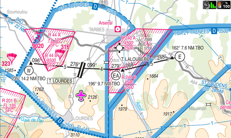
Aeronautical Database
Updates every 28 days. Subscribe now!
- Jeppesen Data Low Airways / Victor Airways included
- Avioportolano (Italy)
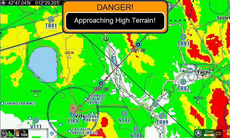
Background and Land elevation
Updates once a year.
- Background overview: terrain depiction based on the world altitude
- Land Elevation for TAWS
- HERE data (major roads).

Street Maps
Updates 3 times a year.
Detailed terrestrial coverage with Street Network and POI by HERE.
Approach Plates and Airport diagrams
Updates every 28 days.
For 40 European countries / United States by Seattle Avionics.
VFR charts
- Digital FAA sectional charts for United States (updates every month)
- IGN OACI VFR chart for France (optional)
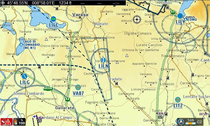
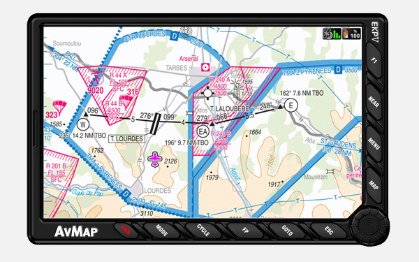
EKP V map representation

Build your desired map view
As all the objects are in a vector format, you can build three custom map views choosing the data you need most, and you can switch from one view to another with a click of the cycle button.

What matters first
Maps have been designed so that what matters to you appears first, for example, taller vertical obstructions are drawn first and appear more relevant. Sorting of airports points is done by their type so that less important airports never overlap more important ones.
Clutter Free
The Smart zoom improves readability and makes sure that smaller cities’ names do not hide bigger cities but, the font size varies in relation to what is displayed. AvMap maps include anti-clutter tricks for vertical obstructions: enabling the anti-clutter option the vertical obstructions are drawn in a semitransparent way.

Highlighted aeronautical data
You can highlight the aeronautical data with respect to the terrestrial ones so that you can always find what you need quickly, without loosing map detail. Different colours for terrestrial and aeronautical names (black / gray) help you also finding what you need faster.

Tidy maps for an easier reading
Colours, fonts and icons have been studied to create tidy and immediate maps. The palette for Land Elevation has been studied to highlight aeronautical navdata and terrestrial fonts.
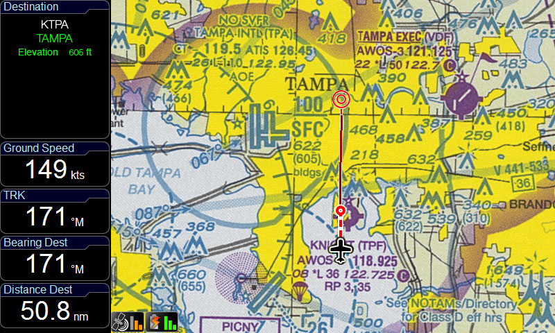
Airport Diagrams and Approach Plates
EKP V is preloaded with approach plates and diagrams of the airports in Europe / United States, provided by Seattle Avionics.
Following a visual approach procedure is very easy: select an airport as destination, open its geo-referenced approach plate and watch your plane icon moving on it.
-
Download your first free update from www.seattleavionics.com/ekpV
-
You can buy a subscription to Seattle Avionics data to receive 13 updates a Year (one every 28 days). www.seattleavionics.com/ekpV
Import your custom maps
In addition of the incredible set of preloaded maps, you can add your own charts! The AvMap Suite helps you converting and importing charts to your EKP V.
How to import your custom maps